The world’s longest rivers affected by climate change are no longer distant environmental case studies. They are living systems that support food, transportation, energy, culture, and biodiversity across continents. As global temperatures rise, rainfall patterns shift, glaciers shrink, and extreme weather becomes more intense, these rivers are changing in ways that affect millions of people. The Nile, Amazon, Yangtze, Mississippi-Missouri, and Yenisei are commonly listed among the longest river systems on Earth, although exact rankings can vary depending on how sources and tributaries are measured.
Climate change does not affect every river in the same way. Some basins face deeper droughts, while others experience stronger floods. In many places, both problems now happen within the same wider system. A river may drop to historic lows during one season and then flood communities during another. Because rivers depend on rainfall, snowmelt, groundwater, wetlands, forests, and temperature, climate stress often spreads through the whole basin.
These changes make major rivers more unpredictable. As a result, farmers may struggle to plan planting seasons, cities may face new water risks, and ecosystems may lose the steady flow patterns they need. For the world’s longest rivers, climate change is not only an environmental issue. It is also a food security issue, an economic issue, and a public health issue.
This ranking looks at the top five longest rivers and explains how each one is being affected. Although river length rankings can vary, these five river systems are widely recognized as some of the longest and most important waterways in the world. More importantly, each one shows a different side of the climate challenge.
Why the Longest Rivers Matter in a Warming World
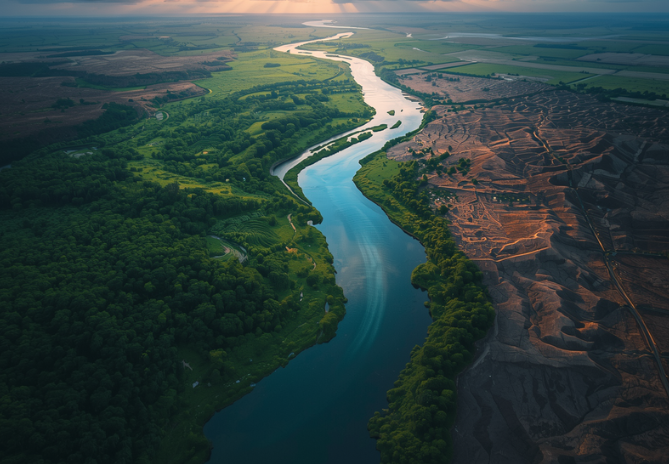
The longest rivers affected by climate change matter because their basins cover huge areas and cross many climate zones. These rivers do not simply carry water from mountains or forests to the sea. They connect farms, cities, wetlands, fisheries, forests, ports, dams, and drinking water systems. Therefore, even a small shift in river flow can create major consequences.
Long rivers also reveal how climate change and human pressure work together. Dams, land clearing, groundwater pumping, irrigation, pollution, and urban development already strain many waterways. However, climate change can make those pressures harder to manage. For example, a river that once handled seasonal drought may now face longer dry periods. Similarly, a floodplain that once absorbed high water may now receive heavier rainfall events.
Because of this, rivers are useful warning signs. When they run too low, heat up, flood more often, or lose biodiversity, they show how climate change is altering daily life. These five river systems are especially important because they influence entire regions and support millions of people.
1. The Nile River
The Nile is one of the clearest examples of rivers affected by climate change. It flows through or near several countries in northeastern Africa, and its basin supports agriculture, cities, wetlands, fishing, and hydropower. For Egypt and Sudan, the river has long been central to farming and settlement. For upstream countries, it is also tied to rainfall, energy development, and regional water planning.
Climate Pressure on the Nile Basin
Climate change affects the Nile through rainfall variability, drought risk, flood risk, and rising demand for water. Some areas may face more intense rainfall, while others may experience longer dry spells. That uneven pattern makes the Nile especially difficult to manage. A wet year can bring flood danger, while a dry year can strain irrigation and drinking water supplies.
In a basin where agriculture depends heavily on predictable water access, uncertainty can quickly affect food production. Farmers may struggle to plan planting seasons, while governments must balance storage, hydropower, and downstream needs. Because the river crosses borders, water management also requires cooperation between countries with different priorities.
Another concern is the Nile Delta. Like many large river deltas, it faces pressure from sea-level rise, land subsidence, reduced sediment supply, and coastal flooding. For communities near the coast, this can mean saltwater intrusion, damage to farmland, and greater flood exposure. Therefore, the Nile’s climate story is not only about having too little water. It is about extremes, uncertainty, and growing pressure on one of the world’s most historic river systems.
2. The Amazon River
The Amazon is another of the world’s longest rivers affected by climate change, and its importance goes far beyond South America. The Amazon Basin contains the world’s largest tropical rainforest, supports extraordinary biodiversity, and helps regulate regional climate patterns. Because the river and forest are deeply connected, climate impacts on one can affect the other.
Drought, Floods, and Forest Loss
The Amazon faces a troubling combination of drought, heat, flooding, deforestation, and ecosystem stress. In recent years, the basin has experienced stronger swings between low-water and high-water conditions. Drought is especially dangerous because river transport is essential for many communities. When water levels drop, boats may not move goods, medicine, fuel, or food as easily.
Fishing can also decline during severe drought. Meanwhile, warmer water can harm aquatic life. In some areas, lakes and channels may become dangerously hot for fish and river dolphins. These changes can damage local food systems and threaten species that depend on healthy river habitats.
Flooding creates a different set of problems. High water can damage homes, contaminate water supplies, and disrupt crops. Across the Amazon, many people live with seasonal flooding, but stronger or more unpredictable floods can overwhelm traditional coping patterns. If floods arrive at unusual times or reach unusual heights, families may lose crops, animals, or access to basic services.
The Amazon also shows how climate change and land use reinforce each other. Forest loss can reduce the moisture recycled through the atmosphere. As forests shrink or become degraded, regional rainfall patterns can weaken. Then drought stress can make forests more vulnerable to fire and dieback. This cycle can place both the river and rainforest under deeper stress.
Among rivers affected by climate change, the Amazon stands out because it is both a water system and a climate system. Its future depends not only on global emissions, but also on forest protection, Indigenous land rights, fire management, and sustainable development across the basin.
3. The Yangtze River
The Yangtze is the longest river in Asia and one of the most economically important waterways in the world. It runs through China and supports major cities, farming regions, hydropower, shipping, fisheries, wetlands, and industrial zones. Because so many people and economic systems depend on it, climate disruptions along the Yangtze can have enormous consequences.
Economic Risk and Water Stress
The Yangtze is one of the longest rivers affected by climate change through droughts, floods, heat waves, and shifting rainfall. During dry periods, low water levels can disrupt shipping, reduce hydropower output, and strain irrigation. During extreme rainfall, floods can threaten cities, farmland, and infrastructure. These risks are especially serious because the river basin is highly developed.
Climate change affects the Yangtze through both temperature and precipitation. Warmer conditions can increase evaporation, which may worsen drought stress during dry periods. At the same time, a warmer atmosphere can hold more moisture, which can contribute to heavier rainfall events. Therefore, the river can face both low-flow and flood risks.
The Yangtze also depends on water from upland regions and tributaries. Changes in snow, glaciers, and seasonal rainfall can influence how water enters the system. If runoff timing changes, reservoirs and water managers must adjust. This is important because large dams and water projects play a major role in the basin.
Biodiversity is another concern. The Yangtze has already suffered from pollution, dam impacts, overfishing, habitat loss, and species decline. Climate change adds another layer of pressure. Warmer water, altered flows, and extreme events can disrupt breeding patterns and reduce habitat quality. As a result, conservation becomes harder when climate conditions keep shifting.
The Yangtze’s story shows that climate resilience is not only about preserving wild rivers. It is also about managing heavily used river systems wisely. Better flood planning, wetland restoration, water-saving agriculture, pollution control, and climate-informed reservoir management can help reduce risks. However, the scale of the basin makes this a major long-term challenge.
4. The Mississippi-Missouri River System
The Mississippi-Missouri River system is one of the longest river systems in the world and a central feature of North America. It drains a vast area of the United States and supports farming, shipping, drinking water, recreation, wetlands, and industry. Because the basin stretches across many climate zones, it is especially exposed to changing rainfall patterns and extreme weather.
Flooding, Drought, and Agriculture
This system belongs on any list of rivers affected by climate change because it faces both severe flooding and damaging drought. Heavy rainfall can increase flood risk in some parts of the basin, while drought can lower river levels and disrupt barge traffic. Since the river is a major transportation route for grain, fuel, fertilizer, and other goods, low water can create economic problems far beyond the riverbanks.
The Mississippi River also supports some of the most productive agricultural regions in the United States. Climate stress can affect farmers through spring flooding, summer drought, soil erosion, and drainage problems. When heavy rain falls on fields, it can wash nutrients into waterways. This runoff can worsen water quality and contribute to downstream ecological problems.
At the same time, drought can reduce soil moisture and increase irrigation demand. If dry conditions persist, crops may suffer and river navigation may become more difficult. The result is a river system that can swing between too much water and too little water, sometimes within the same year.
The lower Mississippi and its delta face additional risks from sea-level rise, land loss, storms, and reduced sediment movement. Deltas naturally need sediment to rebuild land. However, levees, channels, dams, and development can limit where sediment goes. When this combines with rising seas and stronger storms, coastal communities and wetlands face greater danger.
The Mississippi-Missouri system shows why climate adaptation must include both inland and coastal planning. River management, floodplain restoration, soil conservation, wetland protection, and smarter infrastructure all matter. Without these steps, climate change may continue to magnify old problems while creating new ones.
5. The Yenisei River
The Yenisei River system flows through northern Asia and reaches the Arctic Ocean. It is often listed among the world’s longest river systems, especially when measured with connected headwaters such as the Angara, Selenga, and Lake Baikal system. Because it flows through Siberia and into the Arctic, it offers a different view of rivers affected by climate change.
Arctic Warming and Permafrost Thaw
The Arctic and subarctic are warming faster than many other parts of the world. This matters for the Yenisei because temperature changes can alter snowmelt, ice cover, permafrost, river timing, and ecosystem patterns. In cold-region rivers, climate change can affect not only how much water flows, but also when ice forms and breaks.
Earlier snowmelt can shift seasonal flow patterns. If spring melt arrives sooner, the timing of high water may change. This can affect wetlands, fish, river transport, and communities that depend on predictable seasonal cycles. In some areas, warmer conditions may also increase runoff, while in others they may change soil moisture and groundwater behavior.
Permafrost thaw is another major issue. When frozen ground thaws, it can release sediment, organic matter, and stored carbon into waterways. It can also destabilize riverbanks, roads, pipelines, and buildings. For northern communities and ecosystems, this creates practical and environmental risks.
The Yenisei also connects to the Arctic Ocean, where freshwater inflow influences sea ice, ocean circulation, and marine ecosystems. Changes in northern river flow can therefore have effects beyond the river itself. A changing Yenisei is part of a larger Arctic transformation.
Although the Yenisei basin has fewer large cities than some other major river systems, it still matters globally. It shows how climate change is reshaping cold-region hydrology. Among rivers affected by climate change, it reminds us that warming does not only mean drought and heat. It can also mean thawing ground, weaker ice seasons, altered snowmelt, and changing Arctic freshwater flows.
What These Rivers Reveal About Climate Risk
These five rivers affected by climate change reveal a shared pattern. The main problem is not only that rivers are getting lower or higher. Instead, the problem is instability. Water is becoming less predictable in many places. Dry seasons can become harsher, wet seasons can become more intense, and ecosystems may struggle to adjust quickly enough.
Why River Instability Matters
Another important lesson is that climate change rarely acts alone. The Amazon faces deforestation. The Nile faces water demand and delta pressure. The Yangtze faces heavy development and biodiversity loss. The Mississippi-Missouri faces agricultural runoff, navigation stress, and delta land loss. The Yenisei faces Arctic warming and permafrost thaw. In every case, existing pressures make climate impacts harder to manage.
Still, there are practical ways to reduce harm. Better forecasting can help communities prepare for floods and droughts. Wetland restoration can absorb floodwater and support wildlife. Smarter irrigation can reduce waste. Forest protection can stabilize rainfall and reduce erosion. Stronger international cooperation can help shared basins manage risk more fairly.
Communities also need climate adaptation that fits local realities. A farming village on the Nile has different needs from an Amazon river community or a Mississippi port town. However, all depend on reliable water and healthy ecosystems. Therefore, solutions must combine science, local knowledge, fair governance, and long-term investment.
Conclusion
The top five longest rivers affected by climate change show how deeply water connects the planet. The Nile, Amazon, Yangtze, Mississippi-Missouri, and Yenisei are not just geographic landmarks. They are lifelines for people, wildlife, food systems, economies, and cultures. When their flows change, the effects spread across farms, cities, forests, wetlands, coastlines, and trade routes.
Protecting Major Rivers for the Future
Climate change is making these river systems more unpredictable. Some face deeper droughts, while others face stronger floods. Many face both. Meanwhile, human pressures such as land clearing, dams, groundwater use, pollution, and development often make the impacts worse. This combination creates serious risks, but it also shows where action can help.
Protecting rivers means more than protecting water channels. It means protecting forests, floodplains, wetlands, deltas, groundwater, and the communities that depend on them. It also means planning for a future where past water patterns may no longer be reliable. If governments, businesses, and communities act early, these great rivers can remain resilient. However, delaying action will make the challenges more expensive and more dangerous.
The world’s longest rivers affected by climate change are sending a clear message. Water systems are changing now, and the choices made today will shape how well future generations can live with those changes.
FAQ
- Why Are Long Rivers So Vulnerable to Climate Change?
Long rivers are vulnerable because they depend on large drainage basins with many connected climates, landscapes, and communities. When rainfall, snowmelt, temperature, or land use changes in one part of the basin, the effects can travel downstream. As a result, droughts, floods, water quality problems, and ecosystem stress can spread across wide regions.
- Which Long River Faces the Greatest Climate Risk?
There is no single answer because each river faces different risks. The Amazon faces drought, heat, flooding, and forest loss. The Nile faces water scarcity, rainfall variability, and delta pressure. The Yangtze faces floods, droughts, and heavy development. The Mississippi-Missouri faces navigation disruption, flooding, drought, and coastal land loss. The Yenisei faces Arctic warming and permafrost thaw.
- How Does Climate Change Cause Both Floods and Droughts?
A warmer atmosphere can hold more moisture, which can lead to heavier rainfall events. At the same time, higher temperatures can increase evaporation and dry out soils faster. This means some places may experience stronger floods during wet periods and more severe droughts during dry periods.
- Can River Restoration Help Reduce Climate Impacts?
Yes, river restoration can help. Wetlands, floodplains, forests, and healthy riverbanks can absorb water, reduce erosion, improve water quality, and support wildlife. However, restoration works best when combined with lower emissions, smarter water management, better planning, and strong local protection.
- Why Should People Care About Major River Systems?
People should care because major rivers support food, drinking water, trade, energy, wildlife, and cultural life. Even people who live far from these rivers can feel the effects through food prices, supply chains, climate regulation, and biodiversity loss. Healthy rivers help create more stable communities and ecosystems.